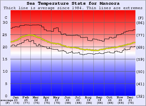
Below is a graph of historical sea surface temperature for Mancora. The information has been derived from analysis of more than 20 years of satellite measurements. This has enabled us to calculate the average water temperature variation around the year as well as the extremes. All of the graphs for the breaks presented on this site are on the same scale to enable comparison between locations around the world. Some further references to this are provided at the bottom of this page.
http://www.surf-forecast.com/breaks/Mancora.shtml
Las Casitas en Vichayito
![]()
990007725
whatsapp 51-990007725
511-2214259 511 422-7741
511-2214259
0